Website Search
Find information on spaces, staff, and services.
Find information on spaces, staff, and services.
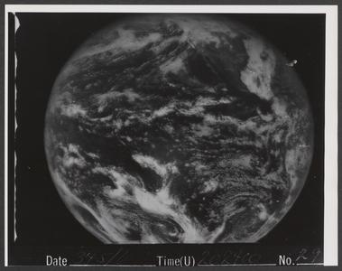
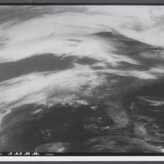
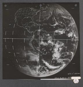
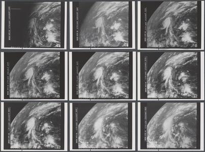
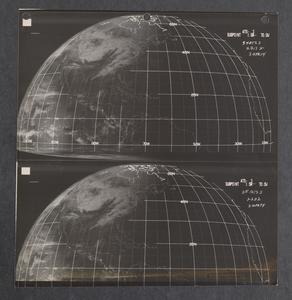
This collection represents a selection of images of weather events as seen from space.
One of the first geostationary satellites, known as the Applications Technology Satellite-I, launched on December 7, 1966. It carried an instrument invented by University of Wisconsin-Madison Professors Verner Suomi and Robert Parent. Their Spin-Scan Cloud Camera ushered in a new era of continuous viewing of weather from space.
Suomi understood the benefits of observing a single weather phenomenon over time and its implications for weather forecasting and public safety. These kinds of observations were not possible using the early polar orbiting satellites.
ATS-I was quickly followed by ATS-III in 1967. The satellite carried a camera that captured the first color images of Earth from space. ATS-III delivered images and data until 1974 and was replaced by the next generation of geostationary satellites with a newer version of the Suomi-Parent camera.
Because of Suomi's successful experiments with ATS-I and ATS-III, our planet has a ring of geostationary imagers that continuously monitor weather events as well as fires, lighting, atmospheric aerosols and other phenomena.
Soon, the full collection of over 63,000 images will be discoverable through the Space Science and Engineering Center's Satellite Data Services.
Images, text or other content downloaded from the collection may be freely used for non-profit educational and research purposes or any other use falling within the purview of Fair Use.
Images from the Applications Technology Satellites are in the public domain; however, when using images from this collection, please use this attribution:
Space Science and Engineering Center, University of Wisconsin-Madison and NASA.
Copied!
Digitization of the ATS images was made possible through a grant from the UW-Madison Space Science and Engineering Center.