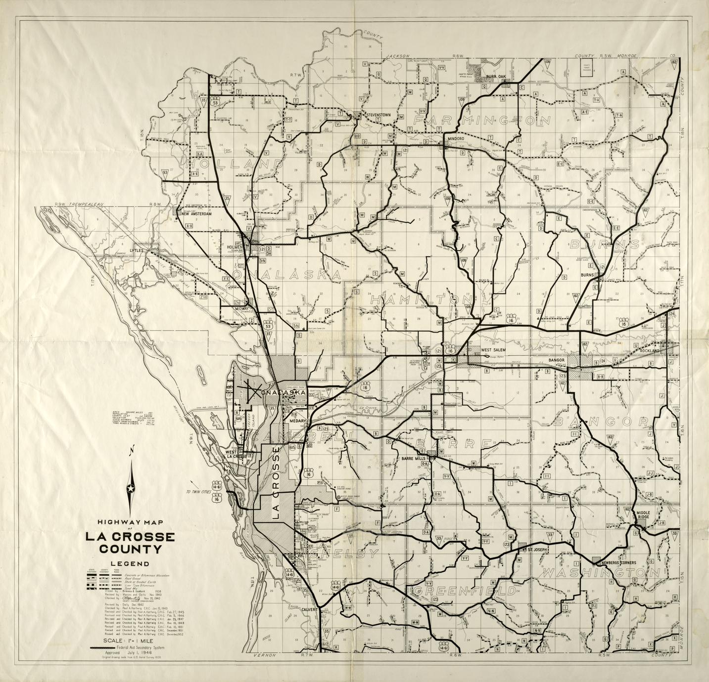
Original drawing made from United States aerial Survey, 1938
Drawn by Birkness and Goddard, 1938
Revised and checked by Paul A. Hartwig C. H., December 1952
Shows United States, state, county and town roads indicating the pavement surface, federal aid secondary roads, townships, towns, coulees, ridges, valleys. county forest preserves, parks, schools, cemeteries, town halls, creeks, rivers, railroads, churches, some development additions
Council Bay, Boy Scout Camp, Girl Scout Camp, Hoeth Forest, United States Government Airway Radio Station, Maple Shade, County Highway Shop, County Asylum, Hylandale Academy, United States Soil Erosion Farm, County Infirmary additions