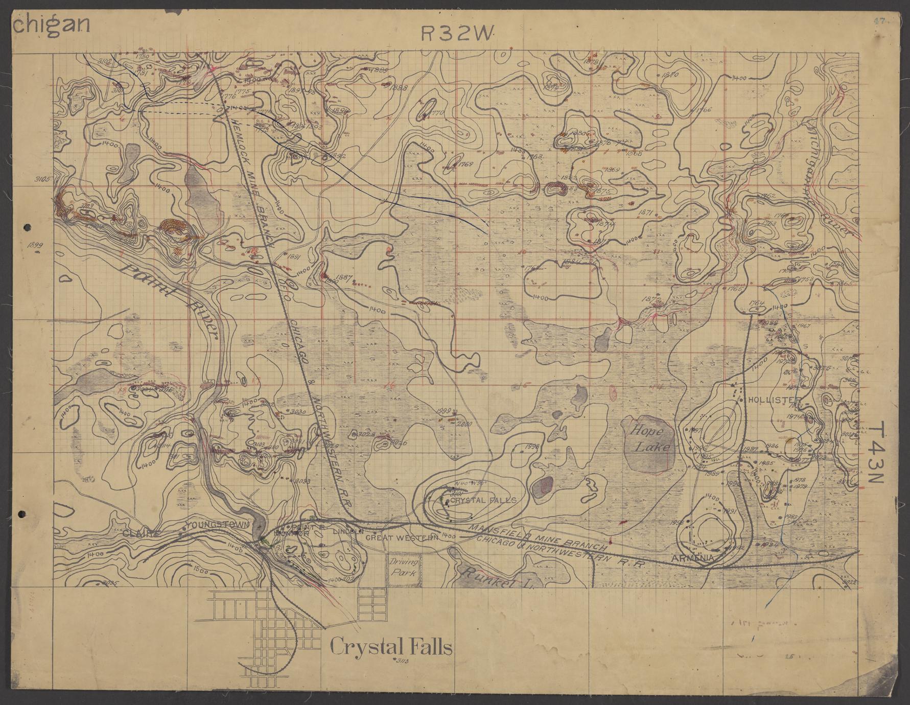
Geological map of area north of Crystal Falls (Iron County, Michigan)
Date
ca. 1895
Summary
Hand-drawn map of Township 43 North, Range 32 West (Iron County, Mich.). Accompanies descriptions in notebooks numbered 288, 289, 291, and 297. Drawings illustrate geological and natural features, including elevation and locations where geological samples were taken. Features include street plan of Crystal Falls, the Paint River, and the Hemlock Mine Branch of the C. & N.W. Railway.