Next available on Monday 9 a.m.–5 p.m.
Find information on spaces, staff, and services.
Search the physical and online collections at UW-Madison, UW System libraries, and the Wisconsin Historical Society.
Find databases subscribed to by UW-Madison Libraries, searchable by title and description.
Find journal titles available online and in print.
Find articles in journals, magazines, newspapers, and more.
Discover digital objects and collections curated by the UW Digital Collections Center.
Copied!
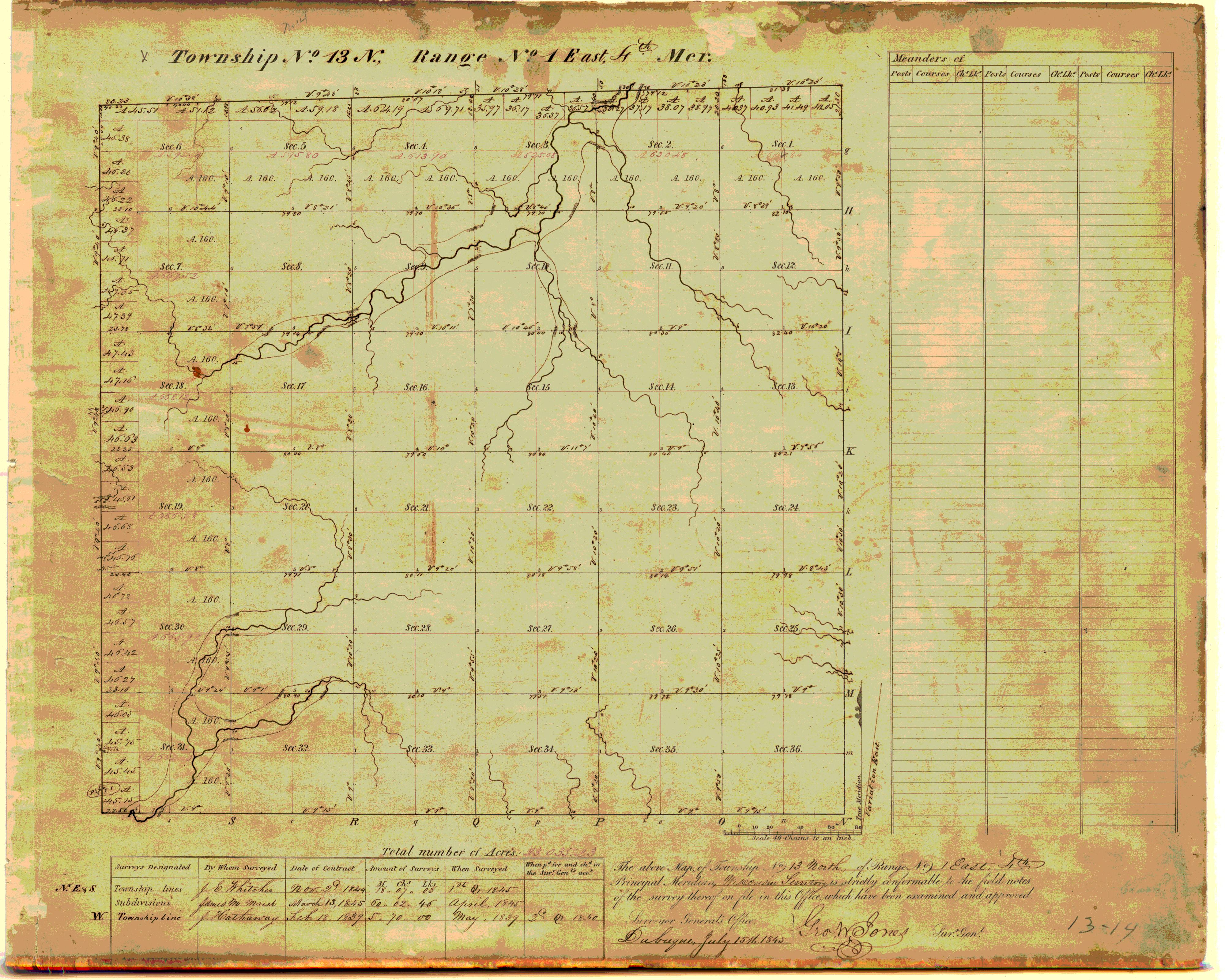
![[Public Land Survey System map: Wisconsin Township 13 North, Range 01 East]](https://asset.library.wisc.edu/1711.dl/RL6XFYHLZSZI382/M/h1380-5f985.jpg)